KEY POINTS:
- In December 2023, Mayor Kirk Watson and the Austin City Council passed Phase 1 of the H.O.M.E.NEXT ordinance, based upon an earlier resolution to rezone and redevelop single-family neighborhoods—enter your address here to see how you are impacted
- In preparation for the plan’s second phase, the Watson council began sending lavender postcards to local residents, proposing to eviscerate compatibility setbacks and create smaller one-unit lots, with smaller setbacks (meaning larger buildings much closer to homes) and mile-wide ETOD upzonings
- Phase 2 of H.O.M.E.NEXT is scheduled for an initial joint hearing by the Watson council and Planning Commission at 9:00 AM on April 11, with a final vote on May 16
The community is mobilizing to save Austin neighborhoods! Individuals and families deserve to have their voices heard and their rights respected, and we must replace the Watson council’s H.O.M.E.NEXT plan with housing decisions based on collaborative community decision-making.
If you want to stop the above, here’s what you can do:
- Mark your calendar and plan to attend the meetings of the Watson council at both 9:00 AM on April 11 and 10:30 AM on May 16. This site explains how to sign up to speak on April 11, either online or in person (you may also use the signup process to simply register your opinion). Remote sign up ends at noon on Wednesday April 10, in person sign up ends 45 minutes before the meeting begins at 10 am Thursday.
- Spread the word about H.O.M.E.NEXT, its compatibility reductions, and the establishment of higher-density districts that do more to encourage 120-foot-tall buildings than they do transit. Share this page with five friends or neighbors today.
- Call or write Mayor Watson and other council members and tell them the following:
I oppose your “H.O.M.E.” initiative and its evisceration of compatibility standards, which will destabilize Austin’s neighborhoods. We need context-specific zoning decisions made on a case-by-case basis, with meaningful public input. Please postpone further action on “H.O.M.E.,” and instead incorporate its elements into a new zoning district to be considered through the regular zoning process. Then create a citizen-led task force to create compatibility standards that are broadly supported by our community, and limit the size of ETODs to a walkable, quarter-mile distance.
H.O.M.E.NEXT—a Primer
A. Land Code Changes Passed in 2023 (H.O.M.E.NEXT Phase 1)
Mayor Kirk Watson and the city council split their H.O.M.E.NEXT neighborhood rezoning for redevelopment resolution into two phases. They passed Phase 1 on December 7, 2023, with Alison Alter and Mackenzie Kelly voting against it. Here is what it did:
More Dwelling Units on Single-Family Lots
Phase 1 authorizes three dwelling units per lot in single-family districts SF-1, SF-2, and SF-3. This means an 11,500-square-foot lot zoned SF-2 or SF-3 can now have six units without a zoning change by resubdividing the existing lot into two 5,750-square-foot lots. If you don’t know your property’s current zoning designation, you can find it by entering your address here.
Structures Closer to the Street
If more than one unit is built on the lot, structures can be located 15 feet from the street.
More Cars on Your Street
Mayor Watson’s council eliminated minimum parking requirements in 2023, so no onsite parking is required. With no onsite parking, cars for multi-family developments will be shifted to neighborhood streets.
More Short-Term Rentals (STRs)
One unit can be used as an STR for a duplex or a two-unit building. STRs are not restricted if there are three units.
Loss of “McMansion” Protections Means Bigger Buildings
Floor area ratio (FAR) is the principal “bulk” regulation, regulating the cumulative size of structures on a site.

Phase 1 of H.O.M.ENEXT increases FAR as additional units are added. If 50% or more of an existing dwelling unit is preserved, it is exempted from the FAR limits. The previous McMansion rules limited FAR to 0.4, meaning a 4,000-square-foot house was allowed on a 10,000-square-foot lot. Under Phase 1 of H.O.M.E.NEXT, if a landowner or developer preserved the existing unit and added two additional units, the FAR could exceed 1.0, more than twice what is allowed today in the McMansion areas.
Loss of Occupancy Limits
Local housing occupancy limits are removed, overriding previous rules limiting occupants to four unrelated people or fewer.
B. Land Code Changes Proposed for 2024 (H.O.M.E.NEXT Phase 2)
The City of Austin sent postcards for delivery around April 1, announcing changes to the Land Development Code and setting public hearings:


Here are among the most impactful changes in the proposed ordinance:
Reduction in Minimum Lot Sizes
The city council is proposing new amendments to permit smaller single-unit residential lots. In most neighborhoods (SF-1, SF-2 and SF-3), the minimum lot size is 5,750 square feet. The city code already has a “single family residence small lot” zoning category (SF-4A) with a minimum lot size of 3,600 square feet. Phase 2 goes below that minimum and proposes even smaller lot sizes of 2,000 square feet for all SF-1, SF-2 and SF-3 properties without an additional zoning change as required with SF-4A.
These smaller lots expand Phase 1 by permitting a single 6,000-square-foot-or-larger lot to be subdivided into three separate lots, each with one unit. That subdivision is facilitated by reducing the minimum lot width to 20 feet, reducing setbacks between structures, reducing front and rear setbacks to 15 feet and 5 feet respectively, and using “flag lots,” which locate one or more lots (the “flag”) behind the front lot with the rear lot(s) accessible by a driveway (the “pole”).
It appears that, for now, the city council has backed off from allowing multiple units across the board on the new small lots, opting instead to multiply small lots with one unit that can be aggregated into row houses facilitated by the short or nonexistent interior setbacks, along with elimination of the requirement that the structures be detached from one another.
Depending on the size of the existing lot, its location, and its street frontage, it will also be possible to increase the number of units beyond the three authorized by Phase 1. For example, 8,000 square-foot or larger lots could be subdivided into four 2,000-square-foot lots if they are located on a corner, have significant street frontage, or use flag lots that utilize one driveway.
The maximum impervious cover in the front yard is limited to 50% (except for flag lots). Building cover limits are removed, but impervious cover is currently capped at 45%. However, the council’s Housing and Planning Committee says the planned ordinance will “adjust setbacks, height, and impervious cover for single-family zoning to allow more units on smaller lots.” HINT: Watch for amendments.
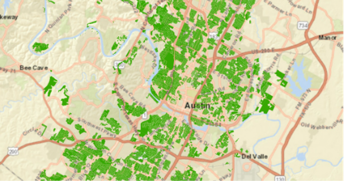
The following map shows the SF-1, SF-2, or SF-3 properties subject to H.O.M.E. Phase 2 in red. An interactive version of this map can be seen here.

Extreme Changes to Compatibility Standards
The city plans to drastically reduce compatibility standards throughout our community. The draft ordinance released on March 29 is here. You can view the current compatibility standards here.
The proposal exempts offices (NO, LO), retail (LR), and apartments (MF-1, MF-2, and MF-3) with a height of 40 feet or less from all compatibility standards. These office retail and apartments adjoining single-family properties are only required to have a 10-foot rear setback to single-family property lines, and a side setback of only 5 feet. The following image shows the mass of 40-foot building.

Forty-foot tall buildings (without NO, LO, or LR zoning) with higher zoning (GO, GR, CS) would have to be separated from single-family properties by a no-build 25-foot buffer. At 50 feet from a residential property line, a 60-foot tall structure would be allowed. That height limit is currently 40 feet. At 75 feet from the residential property line, compatibility control over the height of a building ends, meaning that at that distance, a 90-foot-tall building, allowable in commercial (CS) zoning districts using the city’s density bonus program, could be built. This is shown by the following illustration, shown to scale:

Significantly, developers may also request site-specific amendments (further compatibility reductions) to this new ordinance, “City Council has the full discretion to modify or waive elements of compatibility following a site-specific zoning amendment process with notice and protest rights.” Compatibility waivers would go to the Land Use Commission before the city council. The Board of Adjustment currently hears these cases. The new ordinance does not allow the homeowner to request additional site-specific compatibility protections.
In the proposed ordinance, properties zoned SF-5 (Urban Family Residence) or more restrictive trigger these height limits. This is the same as the current ordinance, except that a single-family use currently triggers the limits even if the zoning is less restrictive.
C. Transit-Oriented Districts: Overview and Analysis
“TODS” or “ETODs” are transit-oriented districts that, in theory, will support transit ridership through high-density development within easy walking distance of transit stations. As seen below, the city council is employing ETODs beyond that purpose to implement a mass-rezoning of property along the Project Connect First Phase and Priority Extensions. It accomplishes this through an “Equitable Transit Oriented District” (ETOD) Overlay, which includes a density bonus feature (DBETOD).
How can I find out if my property is affected?
More than 40,000 people have been notified of this zoning change(C20-2023-004). See the notification here.
| Project Location: | Certain non-Single Family zoned properties within 1/2 mile of the Project Connect Austin Light Rail Phase 1 and Priority Extensions identified as "subject tracts" on attached maps and located generally along North Lamar Blvd., Guadalupe Street, South Congress Avenue, and south of U.S. Hwy 183 and north of Lightsey Rd/Woodward St. |
| Applicant: | CITY OF AUSTIN PLANNING DEPARTMENT, Lauren Middleton-Pratt, Planning Director, 512-974-7220 |
The first hearing is April 11.
The city has released a map with specific parcels (1,095 parcels shown in blue) that it wants to rezone within the overlay. The city intends to rezone all 1,095 properties at once on May 16.
You can see the city’s interactive map of their chosen parcels here. (Try an alternative browser if you cannot view it with Google Chrome.)
What the Ordinance Does
The ordinance rezones identified properties within mapped areas with ETOD and DBETOD overlays. An overlay modifies existing base zoning regulations.
The ETOD overlay prohibits or makes conditional those land uses deemed not transit-supportive. The density bonus overlay is more sweeping and impactful, modifying multiple site development regulations to allow greater height and density for a small percentage of income-restricted housing.
The city describes its density bonus overlay as follows:
The ETOD Density Bonus Combining District (DBETOD) is proposed to: Create a density bonus program that allows residential uses, modifies development regulations to increase maximum height (up to 120 feet), and modifies various site development standards including compatibility standards. It will allow developments to participate in a density bonus program if they provide affordable rental or ownership housing that meets certain requirements.
Here is a summary of significant changes proposed by the ordinance:
Building Height
The city’s overlay authorizes a maximum building height of up to 120 feet through a density bonus. However, this city memo indicates the option for even greater heights remains open:
Additional heights beyond 120 feet will be best considered through the consultant calibration effort for the density bonus program and in the context of planned community engagement to occur as part of Phase 2 of developing the systemwide ETOD Overlay.
Compatibility
Current compatibility standards are dramatically reduced. A minimum 25-foot compatibility buffer is required along a site’s property line shared with a single-family residence. Within 50 feet of a residential lot line, a building may reach 90 feet. Beyond 50 feet, there is no compatibility buffer. This means that under the density bonus overlay, a commercial property that is zoned CS could be built to 90 feet at the lot line behind or next to a home because it is not required to comply with established setback requirements.
Use
The mailed notice contains this disclaimer:
Commercial and industrial uses considered non-transit supportive (e.g., automotive sales, rental, or repair) are prohibited or made conditional uses in the ETOD Overlay.
The ETODs’ Attenuated Connection to Transit
To evaluate the relationship between the proposed ETODs and their stated purpose (transit ridership), we have created a map using the city’s Geofiles and added explanatory information:

You can view the map online here. Search for an address using the search icon on the lower right side.
An analysis of the proposed ETODs shows that the city’s red line indicating a “half a mile from light rail” line seems to exceed the ArcGIS geomodelling program’s calculated half-mile from the station (solid black). The distance from the station to the red city line is, in fact, 0.58 of a mile, not 0.5 mile.

The closeup above raises questions about whether the red line was moved to capture and rezone properties (aqua) more than a half-mile from the station. Other times, as shown below, the city included properties at or beyond the edge of its exaggerated “half-mile from light rail” (red line).

Most important, the city’s proposed ETODs are untethered to transit. The average walking distance to transit is a quarter of a mile. Drawing a circle around a transit station does not indicate a true walking distance. Even with a tight uniform street grid, only 64% of the properties within a transit circle represent quarter-mile walks. The city of of Austin itself does transit access analysis based upon quarter-mile distance to transit. Yet in the proposed ETOD ordinance, the city is using a half-mile (which is really 0.58 mile) distance from the transit line (rather than a transit station) in designating properties for upzoning. Less than 20% of the property they have proposed for upzoning (19.695%) lies within a quarter-mile radius of the stations.
This means that over 80% of the land-area parcels proposed for upzoning are outside the typical walk radius for transit. As proposed, ETODs are being used primarily to promote downtown-type density and traffic outside of downtown, near neighborhoods and schools, not to support transit.
Nevertheless, the city intends to rezone all 1,095 properties on May 16.
You can file a protest with the city using this form. Here are the instructions for turning in the protest.